Donegal has for a long time been the poor relation among the counties of Ireland’s western sea-board in terms of tourism revenue. Be it as a consequence of peripheral remoteness, lack of infrastructure, geographic proximity to the formerly troubled Northern Ireland, or simply due to a lack of marketing, Donegal has been lagging behind its southern counterparts. However, the ‘forgotten county’ may soon be seen and appreciated by millions of people around the world, if the new Wild Atlantic Way signs have their intended impact.
Fáilte Ireland, is to be highly commended for its vision and marketing prowess when conceiving the Wild Atlantic Way brand. Linking Ireland’s most northerly point at Malin Head to the Old Head of Kinsale in the south, via the entire Atlantic coastline, has been a master stroke. The points of interest, hidden gems and seaside towns along the route have since seen a year on year increase of 10% in overseas visitors.
While Westport, Galway, the Cliffs of Moher, the Burren and Killarney have traditionally been magnetic tourist hubs, the Wild Atlantic Way aims to get the more adventurous holiday-maker out along the entire west coast of Ireland.
The first wave (pardon the pun) of rollouts from the Wild Atlantic Way project were the updated road signs which help to guide visitors along the meandering highways and byways. The next project milestone was the marketing blast. Fáilte Ireland was very specific regarding their target audience, with huge campaigns launched in North America and Europe, where there is already a palate for Irish vacations. There have also been escorted promotional tours for Asian journalists and bloggers, who have since brought the Wild Atlantic Way into the hearts of millions of potential visitors from newer markets.
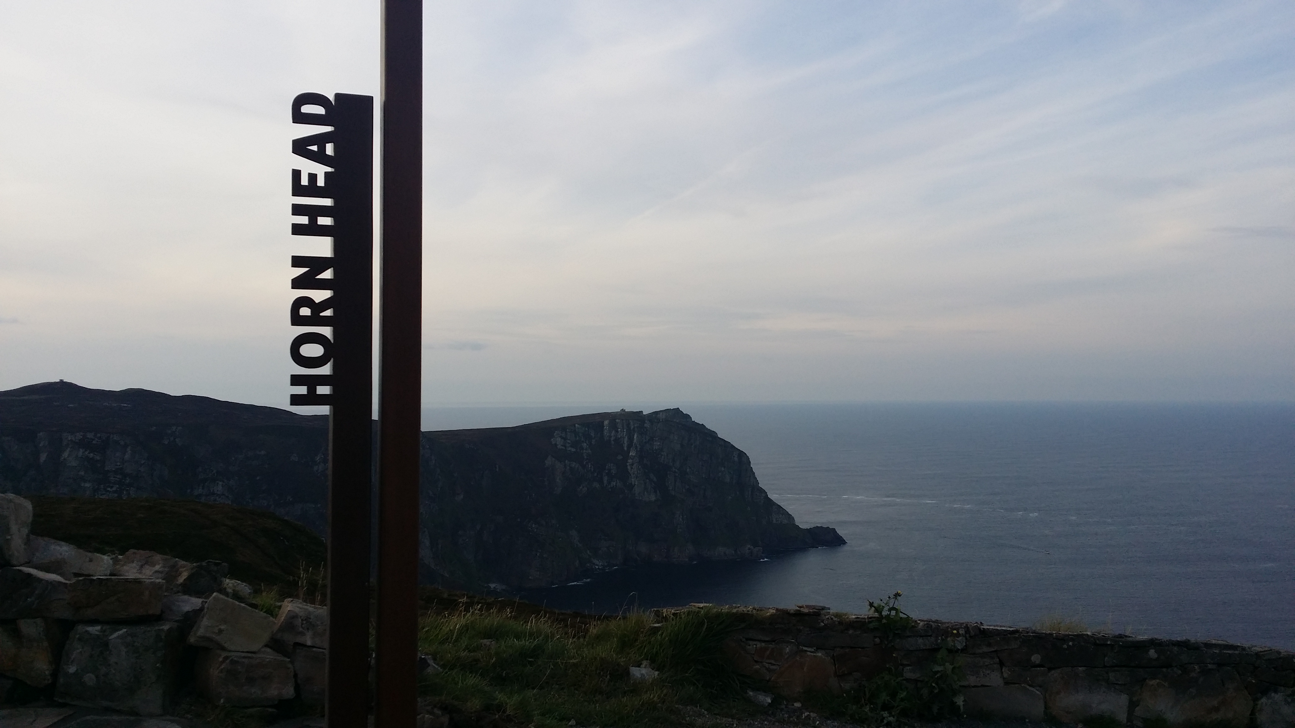
By mid-summer 2015 the landmarks themselves received their first aesthetic upgrade, with the erection of unique identification signs. There has been some criticism regarding their visual protrusion. Any protrusion however, is owing more to marketing strategy than design flaw.
The boxed metal signs which incorporate the Wild Atlantic Way logo and the name of each landmark, really do scream out to the visitor: ‘Hey! Photograph me! Show your friends where you have been, and collect photos of the many other signs too!’
This is really clever marketing by Fáilte Ireland. They are using the actual product to market itself. It encourages visitors to capture the names of the places in their photographs, giving the places a very definite identity, a link to a successful brand, and they encourage the visitor to collect photographs at the other locations too. There is no need to ‘check in’ photographs, as this is not so much about digital tagging. It is physical tagging. These tourist photos will be seen by millions, and the name of the place is right there in the shot. Also, for the tourist, the lure of the signs is a bit like football stickers; if a kid gets a few then he wants them all. From this point onwards, you won’t just visit Westport or the Cliffs of Moher, you will visit a single point on the Wild Atlantic Way.
This connection between the unique places and an overall brand is of particular benefit to Donegal. The Cliffs of Moher currently attracts over a million visitors per annum. The other tourist hubs of the west bring that number higher still. If only a fraction of those tourists become aware of Donegal’s undoubted natural beauty and many attractions as a result of the identification signs, then suddenly there is a captive audience. For marketeers, having a captive audience as the result of state sponsored advertising is like shooting fish in a barrel. If 1 million people like to visit the Cliffs of Moher in a year, then selling other cliffs under the same brand should not be problematic.
The spectacular sea cliffs at Sliabh Liag, which are among the highest in Europe, are an obvious attraction. Banba’s Crown at Malin Head has natural beauty combined with the distinction of being Ireland’s most northerly point. Fanad Lighthouse now offers tourist accommodation and the prospect of climbing to the top of the lighthouse itself, where the panoramic views are among the finest on the Wild Atlantic Way.

Fanad Lighthouse, in north Donegal

Lighthouse at St John’s Point
St John’s Point, which remarkably juts 7 miles out into Donegal Bay, Rathlin O’Birne Island just beyond Sliabh Liag, Inishtrahull Island off Malin Head and the quaint seaside at Stroove all have picturesque lighthouses which are well worth exploring.
Donegal is famed for the many outstanding beaches on its staggering 772-mile coastline. Blue Flag beaches are to be found at the ‘back strand’ in Falcarragh, the shorefronts of Buncranna and Bundoran, at Coral Beach on St Johns Point, at Dooey near Lettermacaward, in Downings, Fintra Beach near Killybegs, Five-Finger Strand (which is home to the largest sand dunes in Europe), the beach near singer Daniel O’Donnell’s home in Kincasslagh, at Kinnagoe Bay where some of the Spanish armada washed ashore, Magheroarty Beach where you can catch the ferry to Tory Island, Murvagh, Pollan Bay near Ballylifin, the surfers’ paradise at Rossnowlagh and at Tra na Rosann.
Ballymastocker Bay near Portsalon, was voted the 2nd most beautiful beach in…wait for it…THE WORLD! Yes you read that right. Ballymastocker was bettered only by a beach in the Seychelles. To put the other beaches of Donegal in perspective, many local folk would not even consider Ballymastocker the most beautiful beach in Donegal! That gives a good indication as to the calibre of beach in the county.
With at least 25 further top quality beaches, among them Bunbeg – home to the iconic Bád Eddie which appeared in a music video by U2’s Bono and Clannad (1.5 million views on youTube). Donegal has arguably the finest stretch of coastline in all of Europe for diverse, naturally beautiful and unspoiled beaches.
The real beauty is that on any given day, you will have them all to yourself. Indeed, Donegal man William Holmes is so impressed by the splendid remoteness of Tramore, to the west of Dunfanaghy, that he has renamed it ‘Solitude’. Access to this heavenly beach requires a peaceful 1.5 mile trek through forrest and over some of the most expansive sand dunes in Ireland.
Donegal also sits at the top table in terms of golf courses. Murvagh, Naran and Portnoo, Rosapenna, Portsalon and Ballylifen are undoubtedly world-class links courses, and the region also includes some fine parkland courses; notably Barnhill in Letterkenny.
If this wasn’t enough, you can venture further off the beaten track to find some of the most amazing coastal locations that you will ever visit, such as Port and Glenlough, with its barren and breathtaking cliffs, stacks, caves and sea arches. Should the coastline leave you overawed, you can venture inland to the wonderful Glenveagh National Park, climb Mount Errigal, or take a shopping day in Letterkenny which was voted Ireland’s Tidiest Town in 2015. The lovely village of Fintown, where the Foyle and Finn sources are found, snuggles into the northwest face of the Bluestack Mountains, and offers a chilled-out train ride along the serene Lough Finn.
Further up in the Bluestacks, Lough Belshade, one of the most untouched places in all of Ireland, offers the more adventurous campers the chance to really get out into the wild. The Poisoned Glen in Dunlewey is another geological marvel. Best seen from the summit of Errigal, Poison Glen, or Heavenly Glen (take your pick depending on a one letter variation in the Gaelige name ‘An Gleann Neamhe’) is steeped in fairytale and folklore, and even has its own resident ghost – The Green Lady. Geologically, this glen, is a fine example of a glacial corrie (or cirque). In fact, most of Donegal is of geological interest, with many of the area’s mountains and valleys cut from the same retreating glaciers that shaped the Scottish Highlands. There are several examples of raised beach systems which act as a museum on Ireland’s tectonic timeline.
Perhaps history is your special interest. If so, then the 6th century home of the Gaelic Kings at Grianan of Aileach will fascinate you, as will Rathmullan – scene of the flight of the earls in 1607. Kilclooney Megalithic Tomb, near the bustling town of Ardara, is one of the finest such examples in Ireland. Beltany Stone Circle in Raphoe is believed to be two and a half thousand years old. The county is also richly populated by castles and forts, for example Doon Fort, which is built upon a clearly defined crannóg on Lough Doon,and is 4000 years old.
So why, you may ask, is this wonderfully beautiful, unique and welcoming county not on the bucket list of every visitor to Ireland? Well, the term ‘forgotten county’ refers to Donegal’s position on the island, and to the subsequent political and social isolation which occurred after the Republic of Ireland emerged from the fallout of the War of Independence and the Civil War. Donegal is bordered mostly by Northern Ireland, sharing only a 10 mile connection with the rest of Republic of Ireland, and is more than 40 miles from its nearest provincial Republic of Ireland neighbor. Donegal has approximately 3 times as much border with the Atlantic than it has with the rest of Ireland. (hence the county has so much potential as a Wild Atlantic Way destination). Donegal’s social, economic, political and geographical position is a complex subject, and is perhaps better explained by viewing a map.

Letterkenny, marking Donegal’s place on the map. Note the tiny border Donegal shares with the rest of the Republic of Ireland en route to Sligo, and the county’s long Atlantic coastline.
During The Troubles, Donegal suffered greatly due to the hesitancy of many people to venture near the border. Were it not for the sporadic trading upturns as a result of a favorable currency exchange rate against Sterling, things would have been much worse. Donegal is now a fashionable getaway location for many people from Northern Ireland, with the towns of Buncranna, Bundoran, Letterkenny and Dunfanaghy benefiting in particular. But overall, the county has a very different tourism demographic and history compared to its southern compatriots.
A large percentage of the overseas visitors who do come, are actually returning Donegal emigrants. These are the people who have for decades been forced to leave their beautiful home due to economic stagnation, when ironically, actual real tourism could have helped towards keeping them at home.
Traditionally, the overseas tourists who journey along Ireland’s west coast, and often as far as Donegal Town and Sliabh Liag, stop short of continuing their adventure through to the beautiful peninsulas of north Donegal. In many local peoples eyes, this is akin to visiting Las Vegas, and not going the extra little bit to see the Grand Canyon.
When the Wild Atlantic Way was launched, many people in Donegal, especially business owners, were optimistic regarding the prospects of finally getting to take their rightful place on the tourist trail. As outlined above, the area has so much to offer the visitor. The product is there. Donegal is renowned for its friendly people. Visitors to ‘the hills’ probably receive a few more than the usual ‘cead mile failte’ that the rest of Ireland is famed for.
With the arrival of the identification markers and the internet and social media marketing which will follow, Donegal may finally be seen by more overseas tourists. While debate regarding the best locations on the Wild Atlantic Way is subjective, it is certainly the case that when all of the pictures of the new landmark signs are shared and viewed by millions of people around the world, Donegal can certainly stand tall and proud. Thanks to the Wild Atlantic Way, the signs may be good for Donegal at last.


